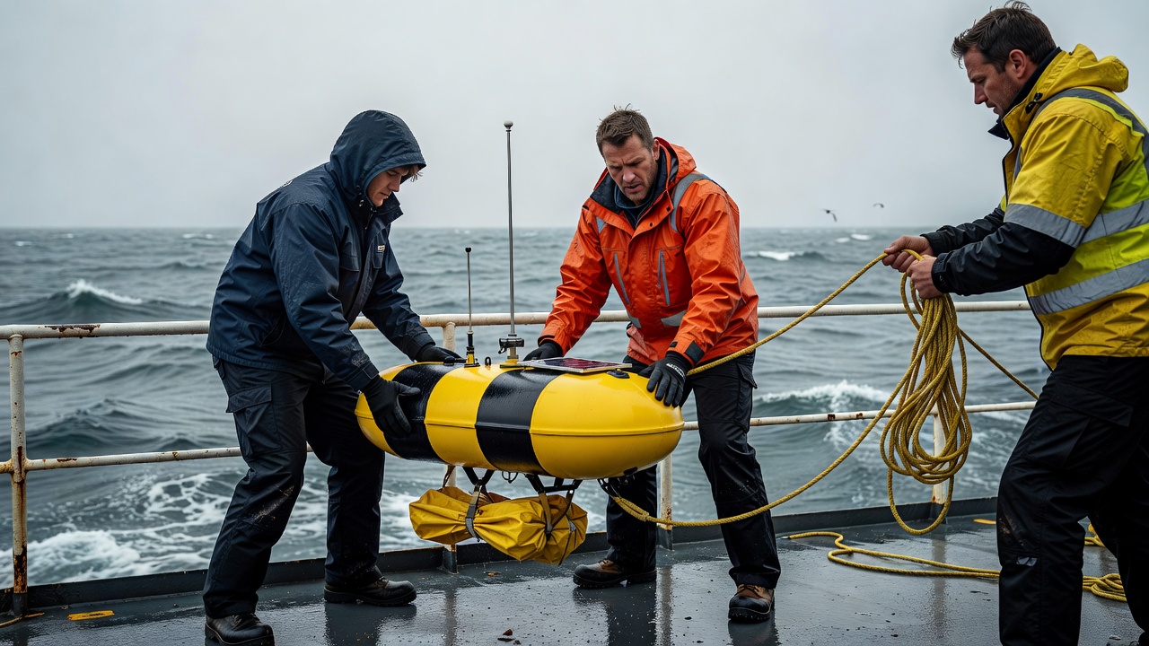
The crew sets the observation in motion
Before release, a team checks the instrument identifier, communications, sensors and deployment location. Safe ship handling matters, as does keeping lines and drogues clear. The first transmitted positions help confirm that the instrument is functioning, but a successful signal does not guarantee a perfect water follower. Researchers need metadata describing the design, intended sampling depth and any subsequent change in condition.
The Global Drifter Program, coordinated through NOAA and international partners, maintains a major source of near-surface observations. Its Surface Velocity Program drifters commonly use a drogue centred at about 15 metres. That detail matters: the instrument is designed to follow water at that level more faithfully than an undrogued object floating at the air–sea interface. It should not automatically be treated as the path of foam, oil or a swimmer.
A position becomes a velocity estimate
A sequence of positions, each with a timestamp, allows an average displacement velocity to be estimated. Dividing displacement by elapsed time sounds straightforward, but position uncertainty and the reporting interval affect the result. Closely spaced fixes may expose location noise; widely spaced fixes can miss a loop or a brief acceleration. Interpolated positions fill a regular time series, not a newly observed journey.
This is a Lagrangian perspective: following an instrument as it moves. A moored current meter offers a more Eulerian perspective by observing flow at a relatively fixed location. The distinction helps explain why a drifter trajectory and a station time series may look very different without either being wrong. They sample different parts of a changing field.
The drogue changes the meaning
Wind acts on the exposed float and on the surrounding surface water. A drogue increases drag below the surface, reducing the instrument’s direct wind-driven slip relative to the target layer. It does not eliminate every mismatch. Waves, shear across the drogue and the instrument’s physical response can still influence its path. Quality flags and design documentation are essential companions to a plotted line.
If the drogue is lost, the same float may become more sensitive to wind and near-surface processes. Treating observations before and after that change as identical can distort a comparison. A researcher should check the estimated drogue-loss time, position screening and processing method before using a trajectory to validate a satellite product or a model. A smooth line is not evidence that the instrument’s behaviour stayed constant.
Profiling floats follow another schedule
Argo floats usually spend part of their cycle drifting at depth, then change buoyancy to collect a profile and surface to transmit observations. Standard core-Argo cycles are often around ten days and include profiles to about 2,000 metres, although missions and float types differ. Temperature, salinity and pressure profiles reveal water-column structure that a surface drifter cannot provide.
The displacement between surface communications can help estimate subsurface drift, but ascent, descent and time near the surface complicate interpretation. It is not a continuous high-frequency record at one depth. Biogeochemical Argo and Deep Argo extend the observing approach with additional variables or deeper coverage. A float’s sensor list, cycle settings and quality-control status determine which questions its record can answer.
One path is not the whole pattern
Imagine a drifter looping inside an eddy in the North Atlantic. Its track can reveal rotation, residence and eventual escape, but neighbouring water may behave differently. Instruments cluster where currents carry them and may leave other regions sparsely sampled. Deployment opportunities also influence coverage. Empty areas on a trajectory map mean missing evidence, not necessarily weak circulation.
Combining many trajectories can reveal statistical patterns, provided their different seasons, depths and instrument states are handled carefully. The AOML drifter resources and Argo documentation explain available quality information. For a new reader, the best habit is to inspect both the map and its underlying record: timestamps, depth, sensor status and gaps. Following water gives a powerful witness, but every witness has a position and a history.